Each week, Connecticut River Conservancy volunteers go out to their local tributary rivers in the Connecticut River valley to monitor for river herring as the fish return to freshwater ecosystems to spawn. These dedicated volunteers provide CRC, the CT Department of Energy & Environmental Protection (CT DEEP), US Fish and Wildlife Service (USFWS), and other partners with valuable data to track where river herring are present and absent. CT DEEP and USFWS monitor at several locations and this joint program helps to provide a more comprehensive understanding of the health of our river herring populations. Many thanks to our partners and volunteers who give this program life!
Fish Update from the Waters
Written by Steve Gephard, former fisheries biologist with the CT Department of Energy and Environmental protection (5/19/2021)
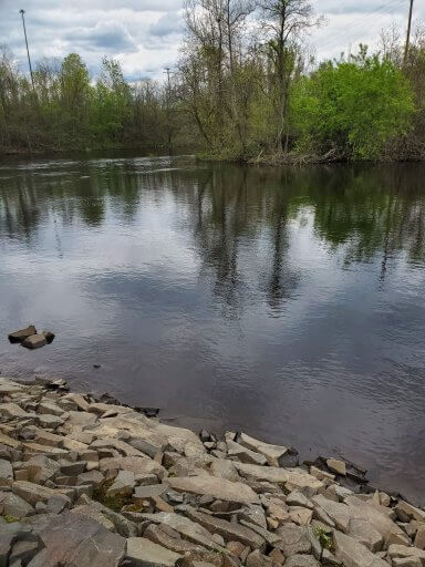
Photo credit: Melissa Vanek.
Finally! Progress! We broke into some real warm weather and the water temperatures are rising. That has resulted in a pickup in fish migrations. The shad count at Holyoke Fishlift has jumped up to 110,000 and some lampreys and a few blueback herring are being lifted, too.
In Connecticut, the alewives are long gone but the blueback herring are in now and a number of volunteer monitors witnessed blueback herring spawning this past week. A large group is now occupying Salmon Cove and lower Salmon River and on occasion, they run up the tributaries to find fast water in which to spawn. They find this habitat at (1) Moodus River at Johnsonville, (2) Pine Brook at the lands owned by Conte Refuge and Haddam Land Trust, and (3) Salmon River at the Leesville dam. They want fast water to distribute their eggs downstream into suitable rearing habitat, which is what the lower portions of these streams are. The fish ascend in waves, typically stimulated by a rise in water temperature. Individual fish may spawn several times during several waves before departing to the ocean. With each wave, you could have some fish that have been in the cove for a while and have already partially spawned previously and you could have some new, virgin fish just arriving from the Sound. A tagging study would be fascinating to learn more but challenging to do right. Ken Sprankle of USFWS, along with UMASS students, is tagging river herring at the mouth of the Connecticut River and there are receivers scattered throughout the river up into Massachusetts and one receiver is in Salmon Cove, but this will only scratch the surface of these some of these questions about local movements.
I saw a very large wave of blueback herring while snorkeling at Leesville Sunday. It could have been the same fish that Dennis, a volunteer, saw at Pine Brook two days earlier. When I was doing my graduate work in the 70s, the bluebacks started running the first of May and sometimes extended into early July. A new wave would arrive at Leesville almost weekly. That’s when there loads of fish. In recent years, there have been years with no waves but typically one wave around Memorial Day, which is typically the peak time. This has been the best year in a while. We already have seen multiple waves. We may have peaked this past weekend, but we’ll see. But volunteers could be seeing more fish right to mid-June. Shifts in timing could be the result of both decline in overall numbers and climate change.
Other species seen: a large number of white perch, all schooling with the bluebacks. There were a few yellow perch hanging out, quite of few smallmouth bass, still thousands of white suckers, with some males still exhibiting spawning colors. The females I have handled in the trap are running freely with ripe eggs. There’s also a large school of spottail shiners coming up from the Connecticut River. It may be too early for them to spawn but they’re there to eat the eggs of the blueback herring. It finally feels like the spring runs are here!
Steve Gephard
Written by Kevin Job, fisheries biologist with the CT Department of Energy and Environmental protection (5/20/2021)
Big news this week is the over 2,000 ALE through Greeneville in 6 days in early April. Lets keep our fingers crossed that this is in response to the 800 fish stocked into Pachaug in 2018. If that is the case, the 9,100 we stocked above Greeneville this year should make for an interesting 2024-2025. I expect the number to climb above 2,000 as we review more video next week. The number to beat is 2,422 in 2002.
Kevin Job
Fish count at the following locations:
- Bunnells: 4,771 (April 27)
- Branford: 550
- Bride: 244,090 (counter pulled, thousands dropping out)
- Hallville: 122 (April 27)
- Fishing Brook: 3,639 (counter pulled)
- Latimer: 6,878 (counter pulled)
- LGL: 980
- Steube: 20,731 (counter pulled)
- Rogers: 2,507 (trap pulled)
- Chapmans: 43 (April 27)
Volunteer River Herring Data from May 10- May 20, 2021
Sunny view of the Chicopee River below its first dam in Massachusetts. Photo credit: Melissa Vanek.
Volunteers this week are reporting lots of fishing activities from anglers and birds! A couple of fishermen told us they saw herring but around this time most of them are fishing for bass. Water levels are leveling out as the season change is almost over. Steve pointed out that we are seeing a surge in migratory fish ascending the rivers as the temperatures are rising; how exciting! We are also very eager to learn more about the tag receivers data collected by Ken from USFWS. Can you imagine being able to visualize how far the herring really travel in our watershed? We have 2 weeks left to go with our program and are grateful for all of the volunteers sticking with it!
The map below displays data report from the season through May 20th, but the color of the pin on the map may only reflects the most recent report. To see a more complete dataset, click on the dot, select “latest Measurements” at the top and click anywhere on the graph. This will pull up all of the reports represented so far.
Featured Site: Chicopee River, Chicopee, MA
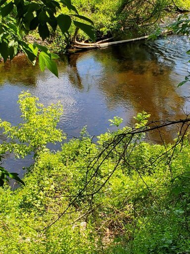
Thank you Melissa for this picture of the north branch of the Chicopee. At the time this picture was taken, the water levels had flooded the lower river bank.
Did you know the Chicopee River watershed is the largest watershed in Massachusetts and the largest in the entire Connecticut River basin? The 721 square mile watershed also holds the Quabbin Reservoir, which is Boston’s primary water supply. This year it is surveyed for migratory fish activity by our most loyal returning volunteers of south-western Massachusetts. We have four sites in total in this watershed; the north branch just below the Chicopee Water Pollution Control Facility, the south branch below the first Chicopee hydropower facility and two locations in the wetlands of the Chicopee river, found south of its mouth. Thank you Melissa, Joan, Ernie and Dianne for your wonderful dedication to this river and this program!
Joan, a volunteer at the Chicopee River site shares her latest experience: “The weather was warm, and very sunny with a lot of clouds. A light breeze rippled the water surface while we were there. Between the ripples, the silt and tannins, and the shadows of the trees on the water, visibility was very poor. We did not see fish, although we did see a number of concentric circles appearing on the water – too big to be bugs, so there may well have been fish. We did watch a muskrat swim across the water. The water level is way down, at least a few feet, making that cove or pool to the south of the path practically nonexistent. This did mean that we could cross over and walk along the Chicopee beyond where we had been able to go. There were two groups fishing in boats across from where we were, but they did not respond to my waves or calls. Likely they could not hear me.” ~ Joan P.
 300dpi")