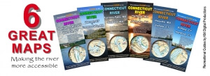
Check out many more guides, books, paper and laminated maps in CRC’s online River Shop. Every purchase supports cleaner, healthier rivers. Shop for good!
Navigational Maps & Guides
The Connecticut River Paddlers’ Trail for launch points and campsites in NH, VT, MA & CT
Boating in Upper Valley: maps, portages and other good information (CT River Joint Commissions)
The Northern Forest Canoe Trail linking NY, VT, NH, Maine, and Québec.
Camping, canoeing, and kayaking in Turners Falls and Northfield, MA (First Light Power Resources)
Places to Visit in Pioneer Valley by Boat on the Connecticut River (Holyoke Gas & Electric)
Water Trails in Connecticut (Rivers Alliance of CT)
Public use areas and access points in central Massachusetts (Holyoke Gas & Electric)
Millers River Blue Trail in northern Massachusettes (Millers River Watershed Council)
River Safety & Flow Information
Boating Safety Guidelines from the Center for Disease Control
Flood predictions and times of cresting
Water release information from dams on Connecticut and Deerfield Rivers
River flows in Connecticut (USGS)
River flows in Massachusetts (USGS)
Detailed River Maps
Prepared by the Trust for Public Land
Connecticut River Sub-Watersheds
Prepared by US Fish and Wildlife Service
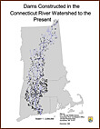
Dams Constructed (as of 1996)
Prepared by US Fish and Wildlife Service
Prepared by Connecticut River Valley Flood Control Commission
Prepared for New England Power, 1996


